

INTRODUCTION
India is a developing nation where the urban areas have key roles in the overall progress of the nation-be it economic, social or any other realm. To aid the country’s sustainable development the Indian government constantly puts in efforts in form of new schemes and reforms. One such scheme which aims at transforming urban India is AMRUT and its sub-scheme of Master Plan Formulation using GIS technology. Master Plans have always been the basis of regulating the urban growth and addressing the various issues within the city. This new sub-scheme under the scope of AMRUT launched in 2015 is being implemented in the states of the nation with the anticipation of favorable end results.
Atal Mission for Rejuvenation and Urban Transformation (AMRUT)
AMRUT or the Atal Mission for Rejuvenation and Urban Transformation was jointly planned and launched by the Indian Government along with Smart Cities in order to upgrade urban infrastructure and transform urban living experience. AMRUT aims at providing basic services to households in the cities to improve the quality of living for all urban residents of India with special priority to the poor residents. According to the Mission Statement and Guidelines of AMRUT, the major thrust areas of the mission are
- Water Supply – to ensure that each household has access to tap with assured water supply
- Urban Sewerage-to ensure connection to sewer lines to each and every house
- Storm water Drainage- to prevent urban flooding
- Green Parks and Open Spaces- to increase amenity value of cities through development of well-maintained green open spaces.
- Urban Transport – to reduce pollution by promoting use of public transport and non-motorized transport systems.
The planning process in India is unable to keep pace with the rate of urbanization in the nation. According to the State Town and Country Planning Departments (STDP), 24% of the towns have a statutory master plan. The continuous urbanization in India is massive and directly impacts economic development of the state. Hence, to address this phenomena, the Indian Government integrated the sub-scheme of Master Plan formulation in the AMRUT Scheme.
GIS Based MASTER PLAN Sub-Scheme of AMRUT Mission
As mentioned above, one of the most important reforms which has been laid down as a sub-scheme of AMRUT Mission is the Formulation of GIS Based Master/Development Plans for 500 AMRUT cities. This sub-scheme targets smaller towns which have no master plans till date or the larger cities whose Master plans are to expire in 2021 and need revision. This reform has been approved as a 100% centrally funded sub-scheme with a budget outlay of Rs. 515.00 crores. The major objective of this sub-scheme are as follows:-
- To develop common digital geo-referenced base maps and land use maps using Geographical Information System (GIS)
- Master Plan Formulation for 500 cities that are selected as AMRUT Cities.
This sub-scheme of AMRUT, revolves around master plan preparation for an urban area and the use of GIS in this process. Understanding Master Plan is hence essential. A Master Plan is the prime tool for urban land management and regulation. It is made for a period of 20 years with periodic review and revision in phases of 15-20 years. It is a dynamic long-term planning document that provides a conceptual layout to guide future growth and development. The main objective of a master plan is to provide land use allocation details for a guided and sustainable development of an urban settlement after exhaustive analysis and study of the natural properties of the city limits.
Use of Geographical Information System (GIS) as an incubator facility in Master Plan Preposition, testing and Formulation
The most vital information required for the formulation of any Master Plan is an updated and flawless Base Map of the planning area indicating each and every detail of the transport network, building layout, natural feature and all information related to every land parcel within the spatial extent of the city. The accuracy and preciseness of base map of an urban area helps in better analysis of economic growth, population distribution, pressure on existing infrastructure and in regulating and controlling the existing urban environment. Hence, it is essential to adopt a tool which enhances the mapping process by reducing any discrepancy in the urban spatial extent. The Geographic Information System is one such tool and GIS based Master Plan Preparation is a step in this direction.
The formulation of Master plan is based on sector-level data analysis from various conducted surveys in the cities. GIS mapping aids here by providing a common database from where
different attributes of a single geo-spatial layer can be utilized for various analysis. Different attributes for each feature can be added to the data and can be used for categorization, analysis and map generation as and when required. For analytical tasks also, dataset can be overlaid on the maps to generate spatial patterns and modes.
Master plan preparation using GIS-based technology will aid in addressing wide range of practical problems in anticipation of future population growth through network analysis, such as route selection and facility location, suitability analysis and problems involving flows, for example hydrology and transportation. GIS not only makes the entire process of Master plan preparation accurate and precise but also reduces time consumption while increasing efficiency in handling large amount of data and its management and in making strategically informed decisions.
Another valuable aspect of geospatial analysis is geo-visualization which is creation and rectification of images, maps, diagrams, charts, 3D views and their associated tabular dataset.
Highlights of AMRUT Scheme, Case Study: The most populous Indian State-Uttar Pradesh
Uttar Pradesh is the state with a population of 19.96 crores as per the Census 2011 which is the highest in the nation. Among this, the urban population of UP is 4.45 crores which is 11.80% of total Indian urban population which constitute 648 towns out of a total of 4041 statutory towns in India. The state ranks 23rd in the level of urbanization although is the largest urban system of the country.
The urbanization trend of UP indicates that the Class-I towns relatively grow faster both in terms of number and their citizen count. This concentration of populace in larges Class-I towns in the state indicates the densification of economic activities. This phenomena of population increase in UP has subjected the urban infrastructure, facilities and services to immense pressure. Hence, it becomes imperative for the state to provide stronger economic and infrastructural base for generating employment opportunities and increasing avenues for entrepreneurship in smaller towns also.
Within Uttar Pradesh, a total of 60 cities are covered by the AMRUT scheme, which includes 14 Nagar Nigam/Municipal Corporation and 46 Nagar Palika/Parishads. The Government of Uttar Pradesh, State Mission Directorate proposed to undertake GIS-based Mater Plan Formulation as follows –
- 35 AMRUT cities of UP under The Urban Planning and Development Act, 1973
- 25 AMRUT Cities of UP under the U.P. (Regulation and Building Operations) Acts, 1958.
The tender for the Master Plan preparation under AMRUT has been floated cluster wise with towns grouped in clusters. The project has been allotted to various consultancy firms for further progress on a cluster based program.
According to the official website of AMRUT, the timeline for the GIS based Master Plan formulation is 48 months. The major challenge in this sub-scheme is the coordination among the planning departments, development authorities, ULBs and Line departments and the data collection from different sources for map preparation and its vetting. The ULBs have been encharged with Reform implementation and capacity building and also responsible for building coordination and collaboration among stakeholders for timely completion of projects without escalation of project cost.
AMRUT supported GIS based Master Plan as a Development Incubator for U.P.
Master planning in UP is still at a nascent stage and needs appropriate techniques and tools for its success. There is a dire need to revamp the development planning process both through legal measures and technological advancement. This is attempted in AMRUT scheme which should act as a development incubator for the state. The scheme aids not only the planning process but also the subsequent implementation which lies thereafter. The following section highlights these aspects of AMRUT.
The GIS based Master Plan reform of AMRUT enhances and equips the master planning process of the cities of UP in its preposition, testing, review and formulation through its following features:-
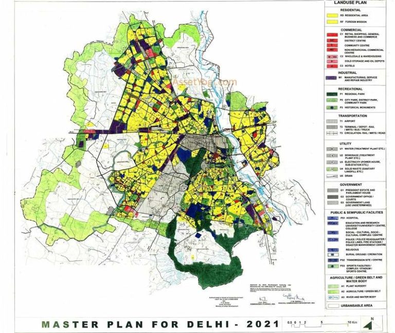
- The AMRUT guidelines has prescribed a detailed land-use color coding and a common symbology for mapping each and every natural or man-made physical feature. This precise colour-coding and detailed symbology have provided the planners and other professionals with a common language for the standardization of the maps.
- AMRUT targets universal coverage, hence the precision of maps also comes to the micro-level of household. In order to achieve accuracy, the satellite data for existing land use preparation is to be procured from NRSC for the towns of UP. Thematic maps, base maps and urban databases are all being created at the scale of 1:4000.
- The digitization of the land-use maps which were absent for most towns in UP will help in easy updation of any land-uses changes within the urban area limits. Real time monitoring of the city is the biggest advantage of mapping in GIS which uses its feature of GPS in combination with remote sensing. For instance, if an urban authority approves any road network development in
the city, it can be instantly incorporated in the map and its effect on the surrounding land uses be studied immediately.
- The GIS environment mapping renders it easy to pin-point any violation of the provisions of the Master Plan without the need of looking up in the maps manually. The digitized platform especially when geo-referenced with help of longitude and latitude removes any ambiguity on ground and improves the legal base for formulation. For example, in 2014 there was a dispute over land use conversion of public park of Kanpur Development Authority into commercial by allotment of shops by Nagar Nigam due to ambiguity of the park’s boundaries.
- Not only this technology based reform will assist in implementation of any reform or policy laid in the master plan with accuracy but will also assist in integration with all other form of development and policies. Hence, it will pave way for online approval of building and infrastructure development which will increase transparency in the entire process. In UP, there are 35 authorities which already have an active online building approval system.
CONCLUSION
Enhancing urban living conditions in 500 cities of the nation of which 60 alone in Uttar Pradesh through this reform is an enormous task in itself. This reform of AMRUT targets smaller towns of the nation which may face difficulties in GIS database management. In coming future, data management in towns where GIS is not a regularly used technology will be essential and a base platform for regulating the development. It is impertinent to note that the AMRUT reform of GIS based Master Plan Preparation is a step forward to the country’s growth and essential to development of large Indian states like Uttar Pradesh where co-ordination, capacity building and fund flow for projects hamper the aims and objectives of schemes in most cases. This scheme has a transparent structure which is formulated with negligible scope for loop-holes. The successful completion of this project will ensure that development is mapped and digitized for the masses and land which is a very important resource is put to optimum utilization.


BrianCic
Thanks very helpful. Will share site with my buddies.
Jamespleax
Keep up the excellent job and generating the group!